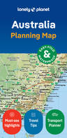
Australia Planning Map 2ed -anglais-
Description
Durable and waterproof, with a handy slipcase and an easy-fold format, Lonely Planet's Australia City Map is your conveniently sized passport to travelling with ease.
Get more from your map and your trip with images and information about top city attractions, walking tour routes, transport maps, itinerary suggestions, an extensive street and site index, and practical travel tips and directory. With this easy-to-use, full-colour navigation tool in your back pocket, you can truly get to the heart of Sydney, so begin your journey now!
Durable and waterproof
Easy-fold format and convenient size
Handy slipcase
Full colour and easy to use
Extensive street and site index
Images and information about top city attractions
Handy transport maps
Walking tour routes
Practical travel tips and directory
Itinerary suggestions
Covers Balgowlah Heights, Balmain, Balmain East, Balmoral, Bondi, Bronte, Castlecrag, Chatswood, Chinatown, Chippendale, City Centre, Cremorne, Crows Nest, Darling Harbour, Darlinghurst, Dawes Point, Double Bay, Dover Heights, East Sydney, Elizabeth Bay, Fairlight, Garden Island, Glebe, Haymarket, Kings Cross, Kirribilli, Manly, McMahons Point, Millers Point, Milsons Point, Moore Park, Mosman, Neutral Bay, North Sydney, Northbridge, Paddington, Point Piper, Potts Point, Pyrmont, Queens Park, Redfern, Rose Bay, Seaforth, Surry Hills, Sydney, The Rocks, Ultimo, Vaucluse, Watsons Bay, Willoughby, Woolloomooloo
Détails
Auteur: Lonely Planet
Date de parution: 26 Septembre 2024
Information complémentaires
EAN-13: 9781787015258
Où trouver ce livre:
(Liste non exhaustives de librairies ayant ce livre en stock. Vous êtes un professionel du livre et souhaitez figurer sur cette carte ? Contactez nous ! )
Vous pouvez également vous raprochez d'une librairie proche de chez vous:
Du même auteur